
Cartes et plans
Cartes et plans
(Page en construction)
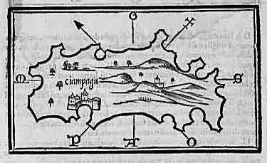
B. Bordone: Ciampagu. Venice 1528. Ca. 8 x 15 cm. This ist the earliest printed European map of "Ciampagu".
http://www.flc.kyushu-u.ac.jp/~michel/serv/eujap/maps/bordone/index.html
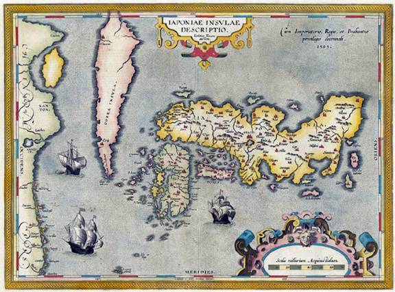
Abraham Ortelius: Japoniae insulae descriptio. Antwerpen 1595. 36 x 48 cm
http://www.flc.kyushu-u.ac.jp/~michel/serv/eujap/maps/ortelius/index.html
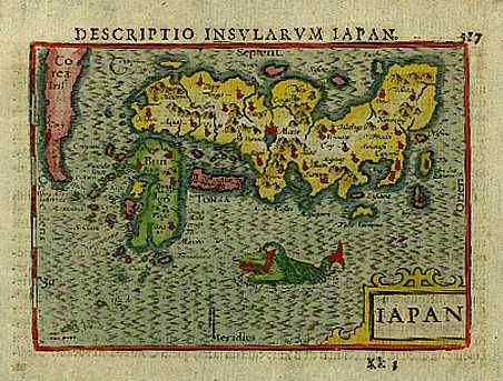
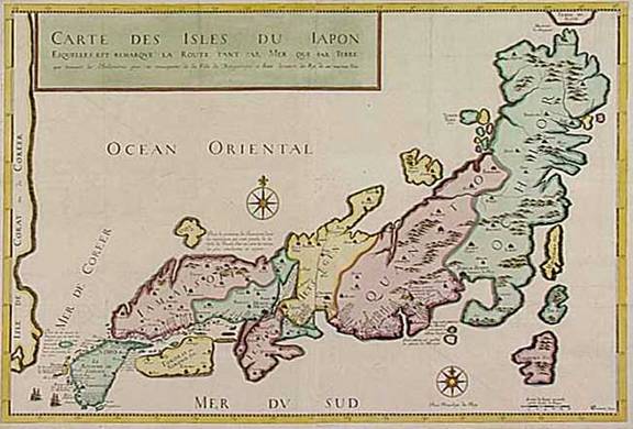
Barent Langenes: Iapan. From Caert-Thresoor [...]
by Barent Langenes ende men vintse te coop by Cornelis Claes.
Middelburg 1598 (ca. 9 x 13 cm).
http://www.flc.kyushu-u.ac.jp/~michel/serv/eujap/maps/langenes/index.html
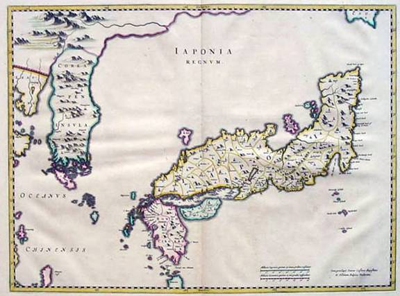
J. Blaeu: Japonia Regnum. Amsterdam 1655. Ca. 42 x 59 cm.
http://www.flc.kyushu-u.ac.jp/~michel/serv/eujap/maps/blaeu/index.html
Jean Baptiste Tavernier: Hern Johann Baptisten Taveniers [...] Vierzig Jährige Reize [...] Nürnberg 1681. Folio. 5 Teile in einem Band. 18 Holzschnitte, 1 Doppelseite mit Japankarte (210 x 315mm). (private collection)
http://www.flc.kyushu-u.ac.jp/~michel/serv/eujap/maps/tavernier/index.html
University of Waterloo
200 University Avenue West
Waterloo, Ontario, Canada N2L 3G1
+1 519 888 4567